COASTALWATCH | WEEKEND SURF FORECAST
Issued Thursday, 21 November 2019
There are the haves and have-nots when it comes to surf potential around the country this weekend. Both Victoria and Western Australia fall into the former category, with solid WSW and SSW groundswells lighting up both states under favourable morning winds both on Saturday and Sunday. South Australia also deserves a mention here, as the state also wears the brunt of the same SW groundswell impacting Victoria, opening up excellent potential as winds swing light northeast on Sunday morning.
In contrast, the forecast for the Eastern Seaboard isn’t looking quite so rosy. In fact, depending on whether you’re a glass-half-full or a glass-half-empty kind of person, the outlook is best described as lying somewhere along a woeful to sub-par continuum all weekend – not to mention next week. On the upside, most of the NSW coast fares a little better – particularly over the next 24 hours. A rapid overnight rise in short-period NE windswell should see consistent 2 to 4ft peaks rolling in across open beaches throughout Friday.
The only caveat is a fresh southerly change arriving in tandem with the new swell; thereby lending the focus more north facing breaks and sheltered southern corners for most of the day. As for the rest of the weekend, there’s a mixture of short-period NE and SSE windswells running at low-levels, probably better suited to your foamier craft.

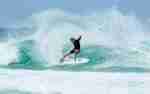
Get ready to roll. Photo: Uploaded to CW by Keavans.
Sydney, Newcastle and the South Coast
The heavy shroud of bushfire smoke blanketing Sydney and surrounds will lift by Friday morning, revealing a new round of NE windswell that holds 3 to 4ft potential across the most exposed spots in the early morning. However, fresh southerly winds will keep a lid on wave-quality across the vast majority of open beaches, limiting the cleanest conditions to the most north facing stretches and southern corners. The southerly wind-regime will remain in place as a trough stalls over the Hunter region– and that looks like translating into a junky mix of smaller-scale Southerly windswell and leftover NE swell on Sunday, with the former wave-train offering up more consistent waves across southern exposures, before small NE swell re-emerges as the primary source of surf early next week.
Friday
NE windswell steadily abates. Sets up to 3 to 4ft across the most exposed open beaches early, more like 2 to 3ft+ elsewhere and fading throughout the day. WIND: Early Southerly change 15 to 25 knots, tending SSE during the day, SE 10 to 15 knots during the afternoon, then lighter Easterly in the evening.
Saturday
Slight NE swell mixing with slight Southerly windswell. Ranging from 1 to 3ft across the most exposed open beaches, inconsistent in the upper range and more like 1 to 2ft elsewhere with size depending on exposure. WIND: Southerly, SSW around 10 knots, tending SSE 10 to 15 knots, then SE to ESE in the afternoon.
Sunday
Mix of NE and SSE windswells up to a bumpy 2ft south facing beaches, more like 1 to 2ft elsewhere with size depending on exposure. WIND: Southerly, SSE 10 to 20 knots, tending SE in the afternoon.

An overnight spike in NE windswell coincides with NE winds, opening up good to great potential across more north facing beaches on Friday morning. Photo: Uploaded to CW by Jmcj.
Queensland and Far Northern NSW
Our November of discontent continues as northerly winds and small-scale surf remain in force across the region. That doesn’t just apply to this weekend – but also to the rest of the month – and probably early December to boot. The good news is there’s a nice little upswing in short-period easterly swell inbound; generated by a low-strength easterly tradewind belt spanning the southern Coral Sea. Admittedly, it doesn’t look like amounting to much; mostly 2ft to near 3ft across the most exposed beaches, but it should hang in around this size all weekend. The quasi-stationary high pressure ridge lying across the region means there’s no end in sight to moderate to strong northerly winds – and that means sheltered northern corners will be the go-to spots for the foreseeable future.
Friday
Short period NE windswell slowly picks up under persistent northerlies. Expect junky sets in the 1 to 2ft range across exposed beaches, bumping up a notch this afternoon. WIND: NNW, Northerly up to 15 to 20 knots, tending NNE in the afternoon.
Saturday
Short period ENE windswell bumps up under persistent northerlies. Sets around 2ft+ exposed beaches, more like 1 to 2ft elsewhere. WIND: NNW, Northerly 10 to 15 knots, tending NNE up to 10 to 20 knots in the afternoon.
Sunday
Small ENE windswell continues at around 2ft+ at the most exposed open beaches, more like 1 to 2ft elsewhere with size depending on exposure. WIND: NNW, Northerly 5 to 15 knots, tending NNE to NE 10 to 15 knots.

In a parallel universe, perhaps. But definitely not in this one. Photo: Uploaded to CW by Ben McGrath.
Victoria
There’s plenty to look forward to if you’re on the surfing programme this weekend. Friday see one final day of mediocre conditions as a small increase in WSW swell arrives under light to moderate onshores. From Saturday morning onwards, however, its game on. The arrival of a powerful WSW groundswell will see set waves progressively building in size throughout the day; conservatively leading in a strong push into the 3 to 5ft range across the Torquay reefs in the afternoon. Admittedly, that coincides with a strong SSW wind-shift on Saturday afternoon, but come Sunday morning it will once again be game-on. As the bulk of WSW groundswell hits full stride we’ll see winds falling away to variable to light WNW, opening up reasonably clean 4 to 6ft conditions all morning.
Friday
WSW swell bumps up under onshore winds. Exposed Beaches: Ranging from 2 to 3ft. Surf Coast: Slow 1 to 2ft sets on the reefs, grading smaller elsewhere. WIND: Early SW to SSW up to 10 knots, tending to Southerly, SSE 10 to 15 knots during the afternoon.
Saturday
WSW groundswell rebuilds under onshore winds. Around 3 to 4ft+ along exposed beaches, rising to 4 to 6ft in the arvo, with scope for larger 5 to 6ft+ sets later. Surf Coast: Wrapping at a clean 2 to 3ft along the reefs, otherwise smaller elsewhere and picking up to 3 to 5ft in the arvo. WIND: WNW to NW around 10 knots, tending Westerly up to 10 to 15 knots ahead of a SSW change 15 to 25 knots in the afternoon.
Sunday
WSW groundswell maintains peak size under early light winds. Exposed beaches: Around 6 to 8ft along exposed beaches, easing marginally in the afternoon. Surf Coast: Sets around 4 to 6ft on the reefs, smaller elsewhere and easing later. WIND: Early light WNW 5 to 10 knots, tending light and variable, then SSE to SE 10 to 15 knots in the afternoon.

The Great Ocean Road is set to turn on right on time for the weekend. Photo: Uploaded to CW by Jordan Smith.
Western Australia
A couple of days of very mediocre, onshore days are set to transmogrify into pumping offshore goodness this weekend. The arrival of a powerful, SSW groundswell inbound from 215 degrees throughout Friday leads in a peak in size in the 6 to 8ft range early on Saturday, preceding a gradual easing trend setting in from there. The groundswell’s arrival fortuitously coincides with a definitive shift in the local wind-regime; characterised by early offshore ESE to SE winds prevailing on Saturday and Sunday mornings, before giving way to stronger southerly quarter winds in the afternoons.
Friday
Reinforcing SSW groundswell bumps up under onshore winds. Southwest: Semi-clean, 4 to 6ft exposed breaks, rising to 6 to 8ft+ during the afternoon. Grading smaller elsewhere with size depending on exposure. Perth: Around 1 to 2ft+. WIND: SW to SSW 10 to 15 knots, tending Southerly, SSE during the afternoon.
Saturday
SSW groundswell slowly settles under light offshore winds. Southwest: Clean 5 to 8ft sets along exposed coasts, easing to 4 to 6ft+ in the afternoon. Grading smaller elsewhere with size depending on exposure. Perth: Around 2ft+ exposed beaches, fading throughout the day. WIND: ESE to SE 10 to 15 knots, fading, before turning Southerly, SSW 15 to 20 knots in the afternoon.
Sunday
Easing SW swell under cross-offshore winds. Southwest: Semi-clean 3 to 5ft sets across exposed coasts early, settling to 3 to 4ft in the afternoon. Perth: Up to 1ft exposed beaches. WIND: ESE, SE 5 to 15 knots tending South to SSW 15 to 20 knots in the afternoon.

The arrival of a powerful SW groundswell coincides with early offshore winds across the Southwest this weekend. Photo: Dan Wyer.
South Australia
A steady improvement in your surfing prospects is on the cards over the next few days, as a building trend in SW groundswell coincides with incrementally better local conditions. This is set to culminate in powerful surf state-wide as winds fall away to light NE on Sunday morning, so if you’re only aiming for one surf, early Sunday by far and away the pick.
Friday
SW swell picks up under onshore winds. South Coast: Junky 2 to 3ft+ at Waits and Parsons, rising towards 3 to 4ft. Wrapping at 1 to 2ft into Middleton to Goolwa and a bit bigger later. Mid Coast: 0.5ft to near flat. WIND: Early WSW to SW around 10 knots, tending to 10 to 15 knots in the arvo.
Saturday
Scope for stronger SW groundswell. South Coast: Speculatively 4 to 6ft at Waits and Parsons, rising to 5 to 8ft. wrapping at about 2 to 3ft+ across Middleton to Goolwa, rising to 3 to 4ft+ during the day. Mid Coast: Around 2ft, bumping up later. WIND: Westerly 5 to 10 knots, tending SW to Southerly in the arvo.
Sunday
SW groundswell eases under light offshore winds. South Coast: Sets up to 5 to 8ft around Waits and Parsons, easing in the afternoon. Wrapping up to 3 to 4ft+ from Middleton to Goolwa. Mid Coast: Around 1 to 2ft. WIND: Early light East to NE 5 to 10 knots, tending to Southerly, SSE seabreezes in the afternoon.

Sunday morning is the pick of the bunch across SA this weekend. Photo: Uploaded to CW by Aidan Gunn.
Please enable JavaScript to view the comments powered by Disqus.


Recent Comments